Map the field. Capture the data. Anywhere.
Field Mapper is a GIS field-data-collection app for crews.
High-precision mapping and ESRI ArcGIS sync on Android, Windows, and the web — even with no signal.
Field Mapper is a GIS field-data-collection app for crews.
High-precision mapping and ESRI ArcGIS sync on Android, Windows, and the web — even with no signal.
Collect in the field on mobile, then track progress, analytics, and compliance from the web dashboard — all in real time.
Deploy on Android, iOS, Windows, and macOS with a single codebase. Native performance and UI on every platform your crew uses.
Work anywhere with MBTiles, GeoPackage, PMTiles, and VTPK support. No internet required — full capability in remote terrain.
Seamless connectivity with ArcGIS Online and Enterprise. Upload attachments, sync layers, preserve domains and attribute rules.
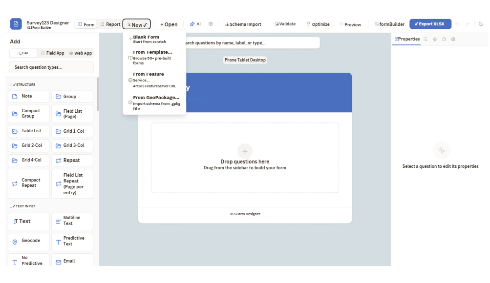
Design custom data-collection forms with a drag-and-drop builder. Add the exact fields your crews need, set validation and conditional logic, and publish instantly to every device.
Organize field work into projects, assign tasks and work orders to specific crews or individuals, and watch progress update in real time across the map and dashboard.
No-code customizable forms with validation, conditional logic, domain-driven fields, photo, signature, GPS, and barcode capture.
Photos, videos, signatures, and barcode scanning with automatic geotagging, GNSS accuracy stamp, and metadata.
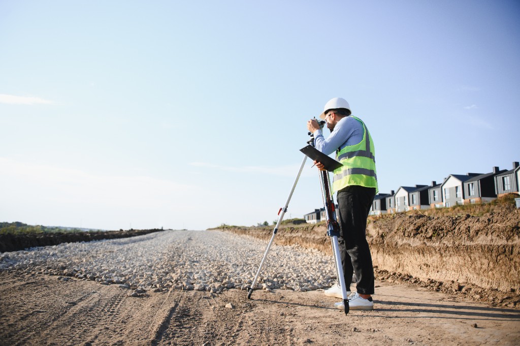
Sub-meter accuracy with Bluetooth GNSS devices including Trimble, Eos, and Bad Elf. Full NMEA parsing with quality metadata.
Beyond data collection, Field Mapper brings on-device analytics, enterprise-grade security, and full data interoperability — everything a professional field organization needs to scale with confidence.
Built-in spatial operations with DuckDB and SpatiaLite for advanced analytics directly on device — no server required.
AES-256 encryption, OAuth 2.0/OIDC with Entra ID support, role-based access control, and comprehensive audit trails.
Convert ESRI Mobile Geodatabase to GeoPackage with full domain and attribute rule preservation across the round-trip.
Wherever crews map, inspect, and collect data, Field Mapper adapts to your industry.
Inspect and map critical assets, network mapping, and work orders across utility networks.
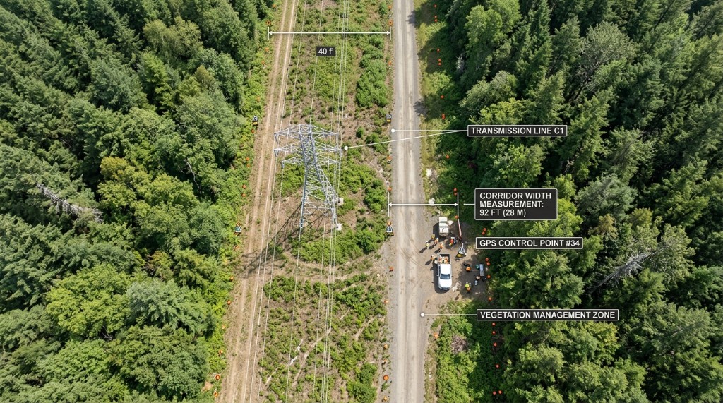
Corridor surveys, hazard tree classification, species documentation, and permit reporting.
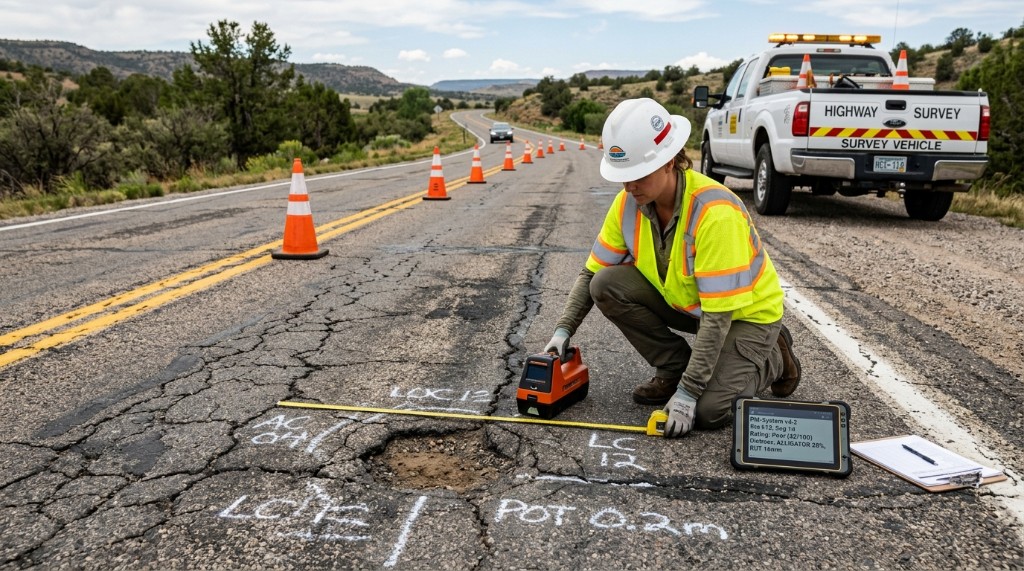
Road condition surveys, traffic sign inventory, pavement management, and structure inspections.

Incident documentation, damage assessment, and real-time crew coordination in the field.

Map fiber optic networks, inspect cell towers, and manage municipal assets or water hydrants accurately.
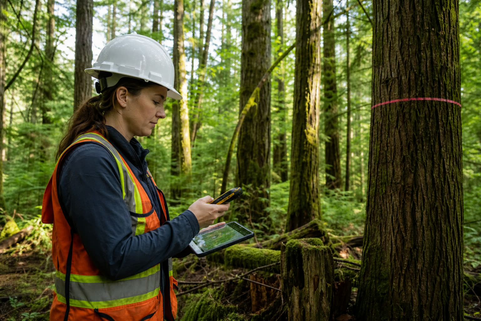
Track wildlife habitats, conduct timber cruising, map wetlands, and monitor environmental compliance in the field.
Field Mapper is a cross-platform, map-based field data collection app for connected or offline use. Crews collect and edit spatial and form-based data, find assets in the field, manage work assignments, and share location — all from one app.
It combines high-precision GIS mapping, a no-code form designer, and task/assignment management in a single offline-first app — with full two-way ESRI ArcGIS integration and open-standard data formats.
Yes. Maps, forms, tasks, and data capture all work fully offline. Records queue locally and sync automatically with conflict handling the moment a connection is available.
Yes. Field Mapper connects to ArcGIS Online and ArcGIS Enterprise for two-way feature service sync, respects domains and attribute rules, and handles attachment sync.
Field Mapper runs natively on Android and Windows, with a companion web dashboard for managers — built on a modern .NET stack.
Join leading organizations using Field Mapper.